Explore the ancient routes and borders with our collection of old maps of Asia, now available for free download. These public domain maps offer a historical glimpse into the continent’s past, perfect for educators, historians, and map enthusiasts looking to print and display vintage cartography.
I was born in Asia, Hong Kong to be precise and that was my family home for the first 30 years of my life. I now live in Europe, but there will always be apart of my heart in Asia.
As well as living on the Asian continent I also have visited many of the countries and traveled around it, mainly overland. I even traveled overland from Hong Kong to Liverpool England. Most of the journey was on the trans-Siberian Railway from Bejing to Berlin.
There are still many countries I have yet to visit in Asia which are on my bucket list. Such as Japan, Vietnam and South Korea.
These old maps of Asia are fascinating to look at. As with the European continent, many of the borders in the Asian continent have changed over the centuries. Check out my collection of maps of Australasia, as some of them include bits of the Asian continent.
Facts About the Asian Continent
Before sharing this wonderful collection of old maps of Asia, I thought it would be fun to share some facts about the continent.
- Asia is the largest of the world’s seven continents. Both by landmass and population. Over 60% of the world’s population lives on the continent.
- It is the most densely populated continent. The most densely populated square mile in the world is Mong Kok in Hong Kong. Which also happens to be one of my favorite places in the world.
- It is home to some of the poorest of people, but also has the highest number of Billionaires in the world.
- The Himalayas are in Asia and have the highest range of mountains in the world including the tallest Mt Everest.
- There are 49 recognized countries on the Asian continent.
Asia has so many diverse ethnic groups cultures and languages. The inhabitants can’t really be pigeon-holed into one single group called Asians.
It’s just that the geographical continent of Asia is just a convenient way of dividing the world which began with the Ancient Greeks.
Asia has been home to some of the greatest civilizations and empires, such as the Mesopotamian, the Mongols, Sumerians, Chinese dynasties, Japanese and South Korean empires and many more.
The Old Maps of Asia
All the following old maps of Asia are in the public domain. They are free to download and use as you wish.
If you click on the title of the map that you want a larger image should open up as a new tab on your browser. You can then print this map of Asia or save it to your hard drive to use at a later date.
For a large scale high-quality print of the map, I recommend using an online print service. Or if printing on your home computer make sure you go into the advanced print menu of your printer software and choose the highest quality print option.
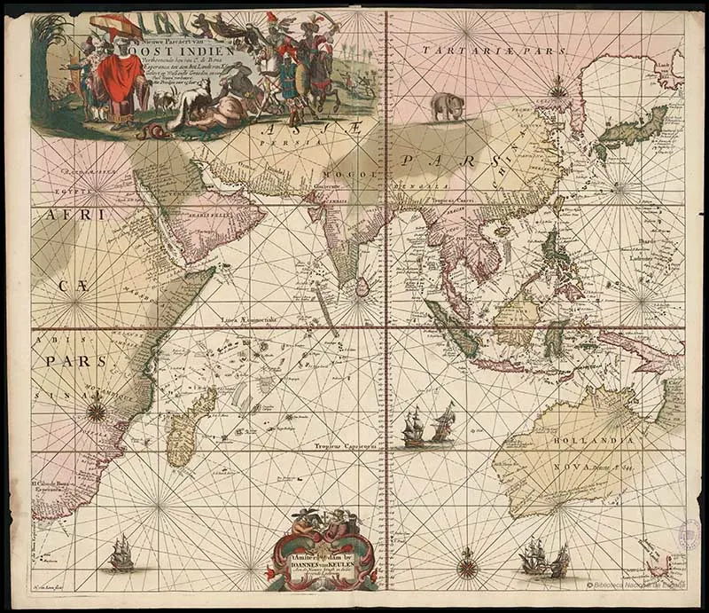
1. Antique Map of Far East, Australia by van Keulen
This old map of Asia is by the famous Dutch cartographer Johannes Van Keulen and dated 1689.
The map shows the Indian Ocean and the coasts of eastern Africa, India, Asia, East Indies, and Australia. It is illustrated with five ships and an Elephant. The map also includes navigational longitudes and latitude grids.
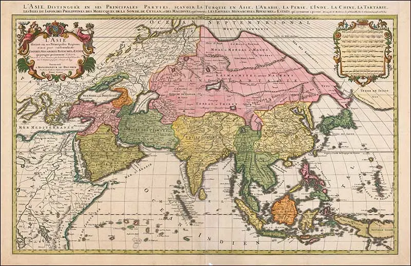
2. 1692 Old Map of Asia
This colorful map is by the French cartographer Hubert Jaillot. It is a large detailed map of Asia and the East Indies.
The French title of the map translates as follows: “Asia divided into its Main Regions, and where it can be spread. Empires, Monarchies, Kingdoms, and Estates which presently share Asia.”
The map shows the Near and the Middle East, Russia, India, China, Japan, Southeast Asia, the East Indies, Philippines and New Guinea. The mapping of Korea, Japan and the surrounding areas is especially interesting.
You can find old maps of China here.
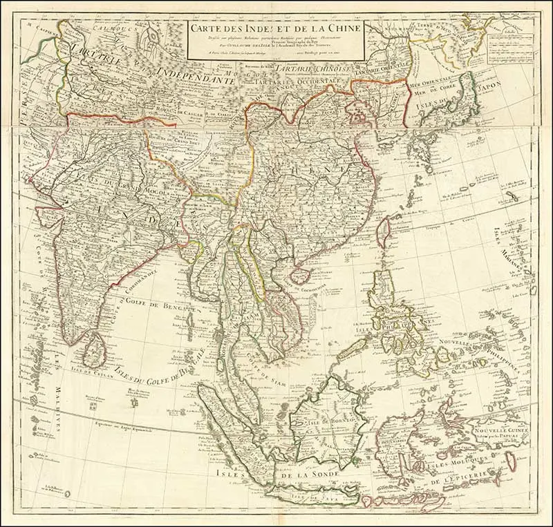
3. Map of India & China
Another French vintage map of the Asian continent, by Guillaume Delisle.
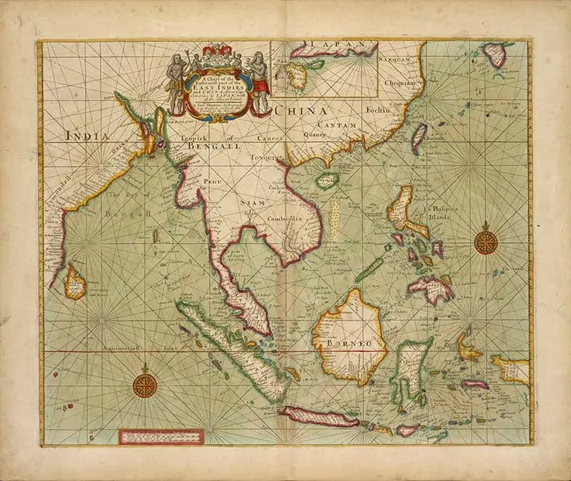
4. 1707 Map of Eastern Most Asia
A chart of the easternmost part of the East Indies and China, from Cape Comarine to Japan, with all adjacent Islands.
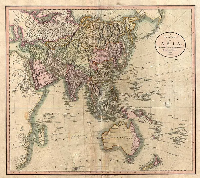
5. 1806 John Cary Map
This is John Cary’s stunning 1806 map of Asia, Australia, and Polynesia. The map covers from the Mediterranean to the Aleutian Islands and from the Arctic to South Africa, Australia, and New Zealand.
This beautiful map is a masterpiece, with mountain ranges, lakes, deserts, and rivers excited with such precision that the result appears almost three dimensional.
Cary injects astounding detail throughout with countless towns, cities, geographical features, rivers, islands and bodies of water noted. In desert regions, freshwater sources are noted and in the seas, certain shoals and undersea are included.
In China and Manchuria, the Great Wall appears. Singapore islands are shown but not specifically named. The Liakhov Islands, in northern Siberia, which some believed to be entirely composed of fossil mammoth ivory, are noted.
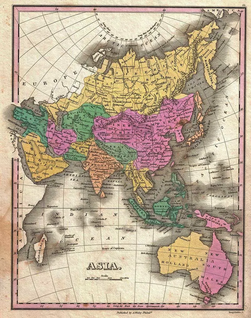
6. 1827 Finley’s Map of Asia & Australia
This old map of Asia covers from the Black Sea and Arabia eastward to the Behring Strait and Papua New Guinea. It includes Australia (New Holland) and the East India Islands with Asia, as was common with 19th Century maps.
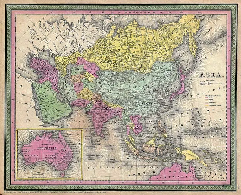
7. 1853 Asian Continent Map
The map is from S. A. Mitchell 1853 New Universal Atlas. The map covers the entirety of Asia as well as the East Indies and Australia. It is color-coded according to regions. An inset map in the lower-left quadrant details Australia.
The map is surrounded by the green border which was common to Mitchell maps from the 1850s.
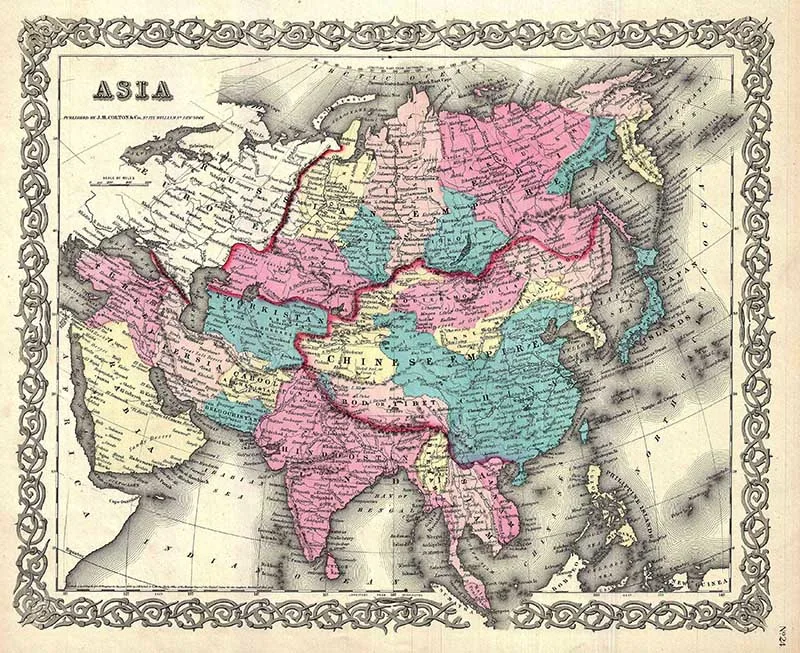
1855 Colton Asian Map
A beautiful 1855 first edition example of Colton’s map of Asia from the George Washington Colton’s 1855 Atlas of the World.
The map covers from the Mediterranean to Siberia and from the Arctic to Singapore. It is color-coded according to regions. The map shows both the Great Wall and the Great Canal in China.
Taiwan or Formosa is mapped vaguely, representing the poor knowledge of the region prior to the Japanese invasion and subsequent survey work in 1895.
Throughout, Colton identifies various cities, towns, rivers and assortment of additional topographical details. Names Singapore, Hong Kong, Macao, Beijing, Shanghai, Edo (Yedo or Tokyo), Mecca, and countless other important cities.
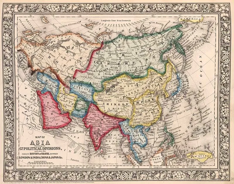
9. 1860 Mitchell Map
Another old map of Asia by Samuel Augustus Mitchell. This map shows political divisions, and also the various routes of travel between London and India, China and Japan.
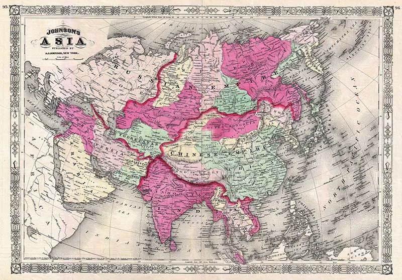
10. 1867 Johnson’s Vintage Map of Asia
This is A. J. Johnson and Ward’s 1867 old map of Asia. The map covers the continent in considerable detail with regional color coding. It also includes parts of Africa, Europe and Polynesia.
In 1867 Johnson did a major re-engraving of many of his maps, including this large double-page preparation of a previously single page map.
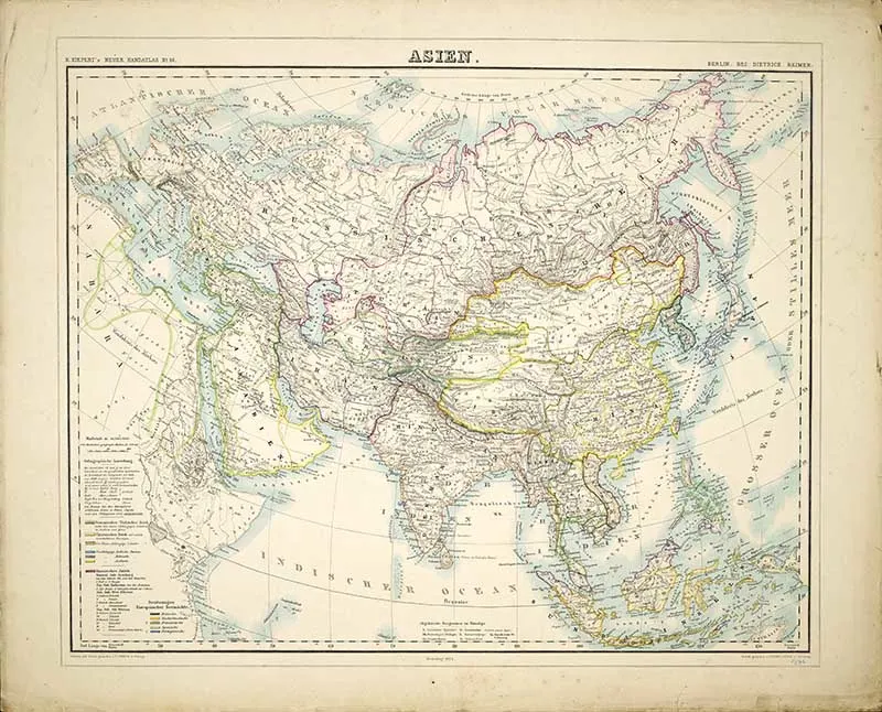
11. 1874 Asien
A Dutch map of the Asian continent from 1874.
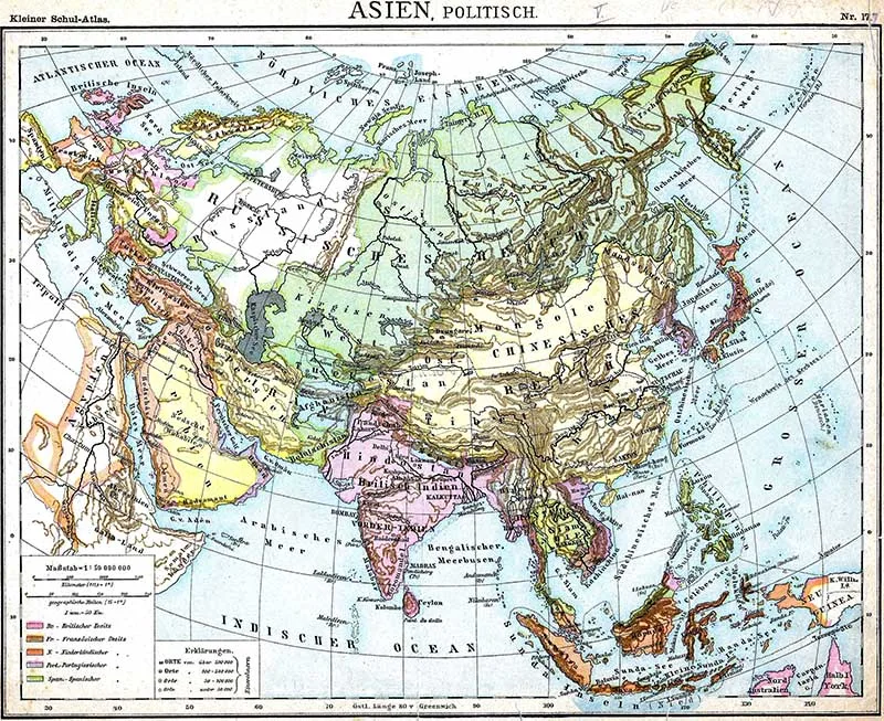
12. 1899 Political Map Of Asia
A Dutch colorful political map of Asia from 1899.
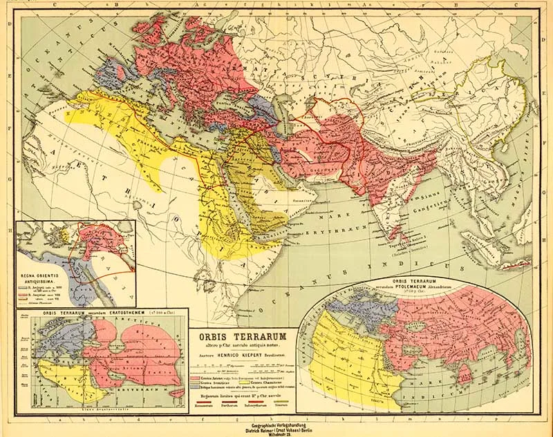
13. Orbis Terrarum
German hemisphere map of the East from 1903.
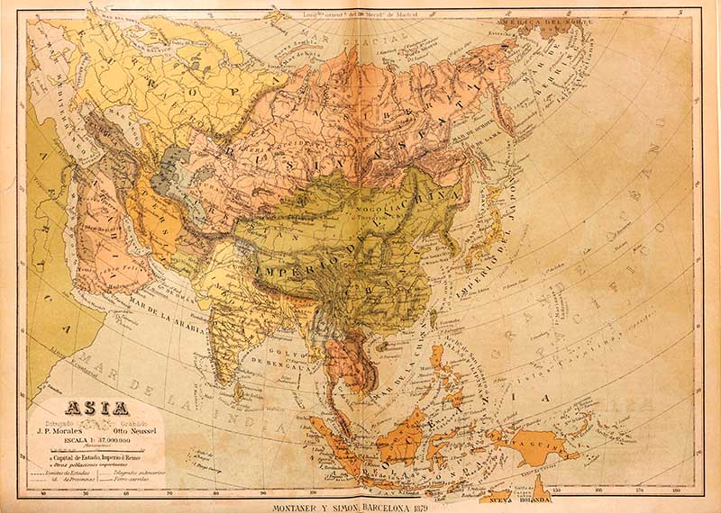
14. 1879 Nueva Geografía Universal
A map from the 1879 edition of the Spanish text “Nueva Geografía Universal“.
15. 1817 Map of Asia
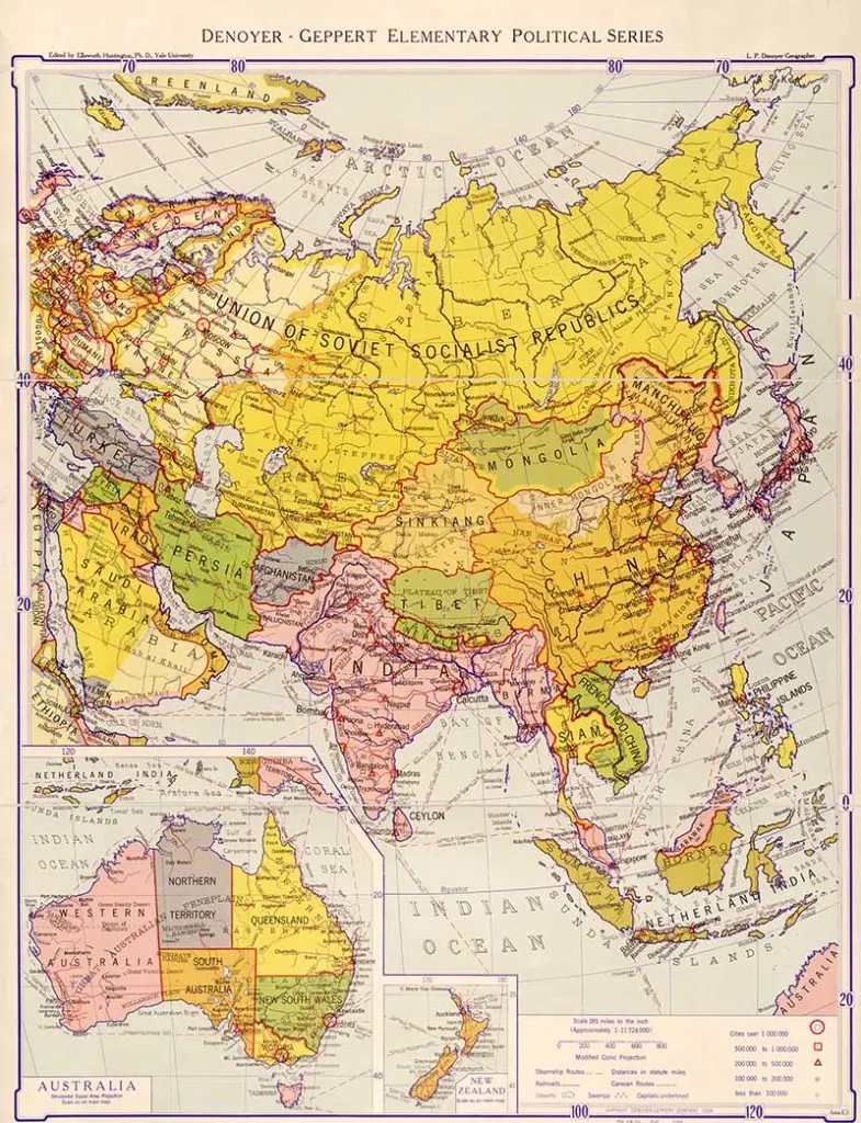
16. 1934 Political Map
This is a map of the Asian continent from an American text book.
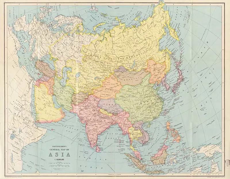
17. Bartholomew’s Map of Asia
This maps is from the 1940’s.
Other Posts To Explore
I hope you have enjoyed these old maps of Asia. There is another wonderful Asian route map in this vintage airline poster collection. You should look at these interesting and colorful antique maps of Japan.
Don’t forget to check out my other continental maps, such as the old maps of Africa, old maps of South America and old maps of Antarctica.
I also have two collections of world maps, one of hemispherical world maps and the other general antique world maps.
For more Asian themed posts check out this wonderful collection of Asian fruit watercolours.


